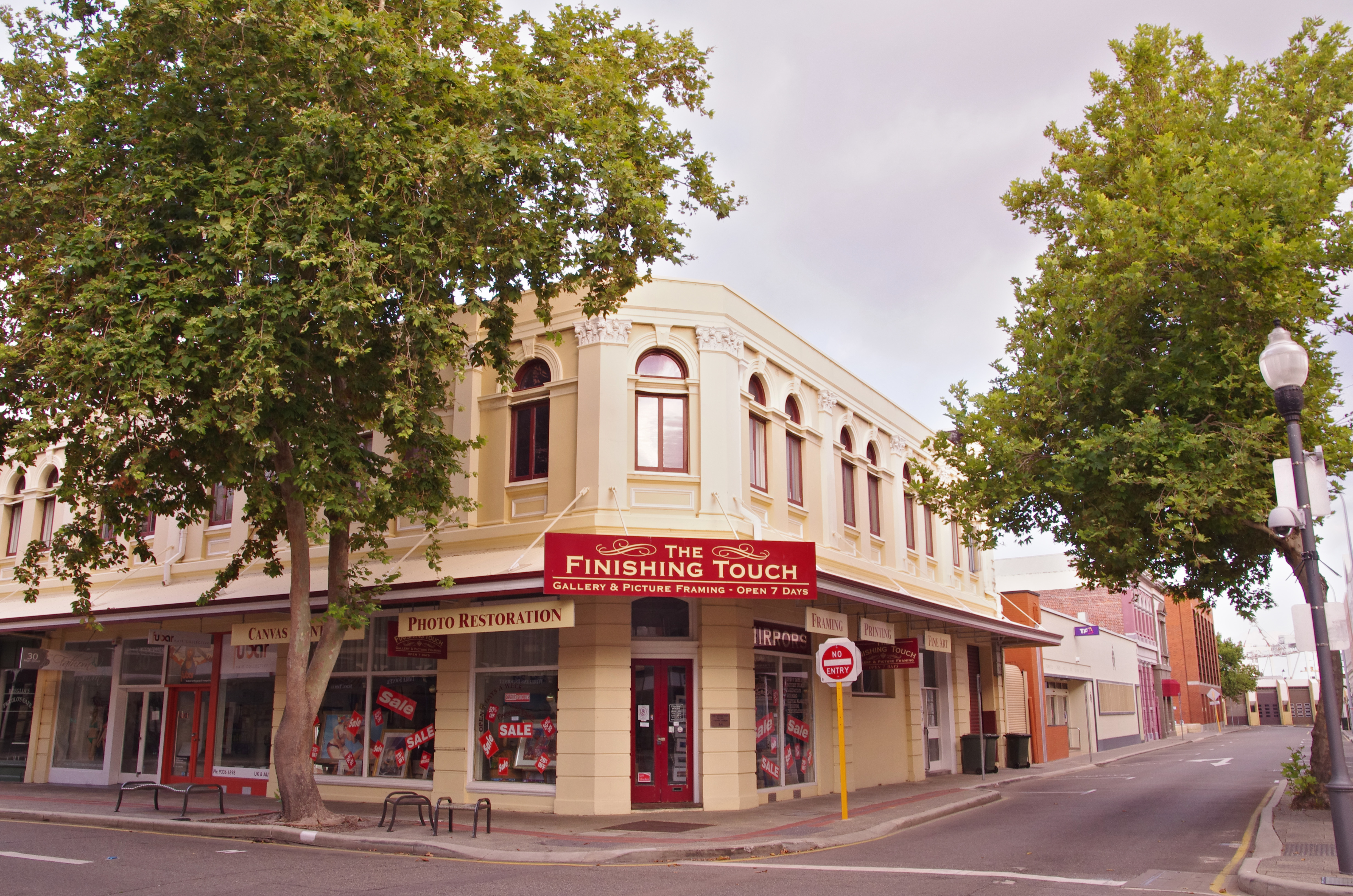
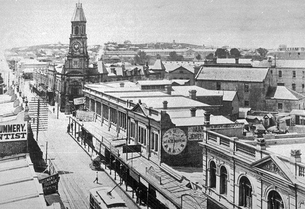
High Street, Fremantle on:
[Wikipedia]
[Google]
[Amazon]

 High Street is the main street running through the City of Fremantle,

 High Street is lined by a significant number of heritage buildings between the

 High Street is the main street running through the City of Fremantle,
 Western Australia
Western Australia (commonly abbreviated as WA) is a state of Australia occupying the western percent of the land area of Australia excluding external territories. It is bounded by the Indian Ocean to the north and west, the Southern Ocean to th ...
. The street passes by historic landmarks, including the Round House
Roundhouse may refer to:
Architecture and buildings Types
* Roundhouse (dwelling), a kind of house with circular walls, prehistoric and modern, all over the world
** Atlantic roundhouse, an Iron Age stone building found in the northern and weste ...
, the Fremantle Town Hall, and the Fremantle War Memorial
The Fremantle War Memorial is a war memorial located on Monument Hill, an 11-acre (4.45-hectare) public reserve and hill in Fremantle, Western Australia. The memorial itself comprises a large obelisk, the Fallen Soldiers' and Sailors' Memorial, s ...
, through the Fremantle West End Heritage area and through two town square
A town square (or square, plaza, public square, city square, urban square, or ''piazza'') is an open public space, commonly found in the heart of a traditional town but not necessarily a true geometric square, used for community gatherings. ...
s. Trams operated along High Street for 47 years, between 1905 and 1952. Running east–west, High Street continues as Leach Highway, a major arterial road, at
Stirling Highway, linking Fremantle with Perth Airport although the stretch of road between Stirling Highway and Carrington Street is known locally—and signed—as High Street.
History
Within twelve years of Fremantle being settled in 1829, High Street was considered the main road of the area. The street was named by the Surveyor-General of Western AustraliaJohn Septimus Roe
John Septimus Roe (8 May 1797 – 28 May 1878) was the first Surveyor-General of Western Australia. He was a renowned explorer, a member of Western Australia's legislative and executive councils for nearly 40 years, but also a participant in ...
, in line with the traditional naming of main streets in England. The east–west route linked the Round House
Roundhouse may refer to:
Architecture and buildings Types
* Roundhouse (dwelling), a kind of house with circular walls, prehistoric and modern, all over the world
** Atlantic roundhouse, an Iron Age stone building found in the northern and weste ...
at Arthur Head to Saint John's Church of England in Kings Square.
High Street was first paved in 1858 with Yorkshire flagstones; however, initially only the northern side of the road was paved. In 1881, the extension of High Street commenced after Saint John's Church sold land for the Fremantle Town Hall, and a right of way
Right of way is the legal right, established by grant from a landowner or long usage (i.e. by prescription), to pass along a specific route through property belonging to another.
A similar ''right of access'' also exists on land held by a gov ...
through Kings Square, to the Fremantle City Council.
In the 1960s, High Street was closed to traffic and made into a pedestrian mall
Pedestrian zones (also known as auto-free zones and car-free zones, as pedestrian precincts in British English, and as pedestrian malls in the United States and Australia) are areas of a city or town reserved for pedestrian-only use and in whi ...
between Queen Street and Market Street. This was carried out as part of a traffic management plan for Fremantle, which reinstated Kings Square as a town square
A town square (or square, plaza, public square, city square, urban square, or ''piazza'') is an open public space, commonly found in the heart of a traditional town but not necessarily a true geometric square, used for community gatherings. ...
, and turned the streets around the square into a one way rotary.
Trams
A plan for an electric tram network in Fremantle was submitted to the City Council in July 1897, that included routes along High Street. However, there was some opposition to the plans from local residents. The details of the tramway scheme were not finalised until June 1904. The Fremantle and East Fremantle councils financed the project through a loan of 80,000 pounds. The first trial runs of trams along High Street were on 30 September 1905, with the system officially opening on 30 October of that year. Trams operated along High Street until 1952, when the trams in Fremantle were replaced by buses. The trams were taken out of service due to their economic costs and to relieve traffic congestion on roads. The last tram service operated was on 8 November 1952.High Street upgrade
The section of High Street between Carrington Street and Stirling Highway was upgraded between 2019 to 2022 to a dual carriageway expressway with a roundabout replacing theT junction
A three-way junction (or three-way intersection) is a type of road intersection with three arms. A Y junction (or Y intersection) generally has three arms of equal size coming at an acute or obtuse angle to each other; while a T junction (or T i ...
with the latter road. The route is part of the main freight access for vehicles accessing the Port of Fremantle, and is a very busy intersection for trucks.
Route description
The street begins at the intersection of Leach Highway and Carrington Street, at Fremantle's eastern edge. It travels west as the continuation of State Route 7, meeting Stirling Highway after , at the highway's southern terminus. This stretch of road between Carrington Street and Stirling Highway is a part of Leach Highway. The road continues west for another , until it reaches Monument Hill at its intersection with East Street and Swanbourne Street. From there it turns south-west, reaching Ord Street after , which is the western terminus of State Route 7. High Street continues south-west, passing, after , through Queens Square, a set of four squares around High Street's intersection with Parry Street. Another along is Queen Street, the north-eastern edge of Kings Square. High Street is a pedestrian mall through Kings square, and for another west of the square, until Market Street. South-west from this point, the street is one-way for , until it reaches Cliff Street. The road's terminus is only further along, at Little High Street, adjacent to the Round House.Historic streetscape

 High Street is lined by a significant number of heritage buildings between the
 Round House
Roundhouse may refer to:
Architecture and buildings Types
* Roundhouse (dwelling), a kind of house with circular walls, prehistoric and modern, all over the world
** Atlantic roundhouse, an Iron Age stone building found in the northern and weste ...
and where it becomes a pedestrian mall, at Market Street just west of the Fremantle Town Hall. The buildings include:
* 1 High Street – Fremantle Municipal Tramways Car Barn
* 4 High Street – Union Bank
* 6 High Street – Hotel Fremantle
* 7 High Street – Bank of New South Wales
The Bank of New South Wales (BNSW), also known commonly as The Wales, was the first bank in Australia, being established in Sydney in 1817 and situated on Broadway. During the 19th century, the bank opened branches throughout Australia and N ...
* 9 – 23 High Street – Owston's Buildings
Owston's Buildings, also known as Ouston's building, is a heritage listed building located at 9–23 High Street on the corner with Mouat Street in the Fremantle West End Heritage area. It was one of many buildings constructed in Fremantle duri ...
* 22 High Street – Westpac Building
* 25 High Street – P&O Hotel
* 28–36 High Street – Adelec Buildings
* 35 High Street – Athena Lodge
* 38–50 High Street – Marich Buildings
* 39 High Street – Orient Hotel
* 41–47 High Street – Union Stores Building
* 61–63 High Street – Central Chambers
* 80 High Street – Commercial Hotel
* 81–83 High Street – R.S.L. Club
* 84 High Street – ANZ Bank Building
* 98 High Street – National Hotel
* 101 High Street – Higham's Buildings
At the town hall the pedestrian mall is crossed by the intersection of Adelaide and William streets it then continues through Kings Square until it reaches Queen Street. The section of road through Kings Square is frequently used for festivals and markets. From Queens Street, High Street continues east until it abuts Leach Highway at Carrington street. Along this section of the road there are a number of further significant places including:
* 160 High Street – Dalkeith House
* 177 High Street – Oriana Cinema
The Oriana Cinema was an art deco cinema and theatre built in 1938 in Fremantle, Western Australia and demolished in the early 1970s.
History
In 1937, a local company, Hoyts (Fremantle) Pty Ltd (formed by local businessmen and Hoyts Theatres L ...
* 179 High Street – Victoria Hall
* 186 High Street – Lenaville
* 200 High Street – Fremantle Grammar School
Fremantle Grammar School is a defunct school and heritage-listed building in Fremantle, Western Australia.
Architecture
The building stands at 200 High Street, opposite Monument Hill. It was built by Melbourne architect Charles Inksep in the ...
* High & Swanborne – Fremantle War Memorial
The Fremantle War Memorial is a war memorial located on Monument Hill, an 11-acre (4.45-hectare) public reserve and hill in Fremantle, Western Australia. The memorial itself comprises a large obelisk, the Fallen Soldiers' and Sailors' Memorial, s ...
* High & Carrington – Fremantle Cemetery
Fremantle Cemetery is a cemetery located in the eastern part (Palmyra) of Fremantle, Western Australia. Established in 1898, it is known as the final resting place of Bon Scott, several murderers and dozens of other notable Australians. There ...
Major intersections
* Leach Highway (State Route 7) east / Carrington Street * Stirling Highway (State Route 5) north * East Street north / Swanbourne Street south * Ord Street (State Route 12) * Parry Street * Queen Street * Adelaide Street north-east / William Street south-east *Market Street Market Street may refer to:
*Market Street, Cambridge, England
*Market Street, Fremantle, Western Australia, Australia
* Market Street, George Town, Penang, Malaysia
*Market Street, Manchester, England
*Market Street, Melbourne, Victoria, Australia
...
* Cliff Street
* Little High Street
See also
Notes
;Route description * {{commons category, High Street, Fremantle Fremantle West End Heritage area Streets in Fremantle Articles containing video clips